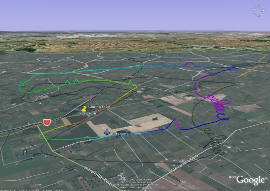
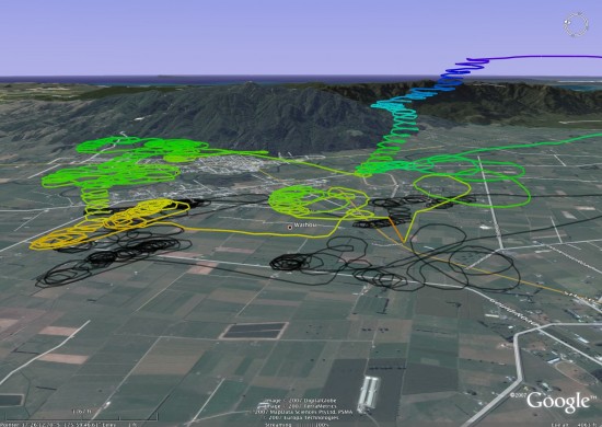
Wouldn't it be nice to view your gliding track in the beautiful 3D high resolution Google Earth? gpsvisualizer.com converts the IGC files, produced by our club loggers, into Google Earth KMZ files. This can then be opened in Google Earth and visualised in 3D just like SeeYou.
Here's what it looks like:
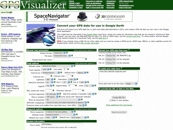
A number of settings on the gpsvisualizer google earth converter page need to be changed to produce the views above. Here's what I changed:
- Set Altitude mode to: "Absolute"
- Colorize by: "Altitude"
- "Draw a shadow" to 30% or what ever you like to see the ground track
- "Units" to US, to view in feet and miles (or should it be Nautical?)
Here's what the settings look like:
Here's the website link again: www.gpsvisualizer.com/map?form=googleearth


Comments
The altitude measurements are always read correctly from the data files, especially if they're in IGC format.
http://www.ywtw.de/igcsim.html
Also a IGC file replay in Google earth